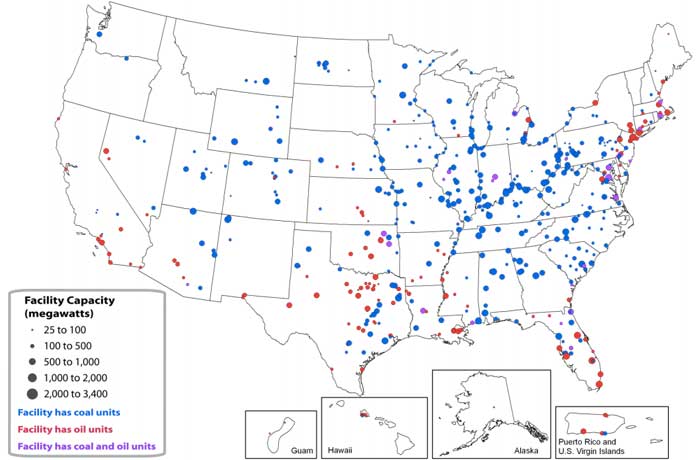
In 2010, coal-fired power plants represented 45% of the electricity generated in the United States and oil a smaller amount, 1%. Combined together they are the dominant air polluters and facing tough new restrictions from the EPA.
Unfortunately, they have a few years to clean-up and that doesn’t help if you live in one of the toxic twenty states. Visit the previous link to see how your state compares, or scan this map to see if any of the polluting power plants are close to you.
Coal and Oil-fired power plants in the United States, 2010

There is also a Google Earth feature that allows you to find power plants where you live.
Its such as you learn my mind! You appear to know so much approximately this, such as you wrote the book in it or something. I feel that you just can do with a few percent to pressure the message home a little bit, however other than that, this is excellent blog. A fantastic read. I will certainly be back.