Many Mongolians consider the tomb (of Genghis Khan) an extremely sacred place and believe any desecration of it could trigger a curse that would end the world.
“Using traditional archeological methods would be disrespectful to believers,” Albert Yu-Min Lin says. “The ability to explore in a noninvasive way lets us try to solve this ancient secret without overstepping cultural barriers.
Lin investigates sites with a high-tech tool kit that leverages photographs taken firsthand on the ground, images gathered from satellites and unmanned aircraft, GPS tracks from expeditions, and geophysical instruments. “There are many ways to look under the ground without having to touch it,” he observes. Thermal-imaging systems show what lies below by detecting heat signals and patterns emitted from the Earth. Magnetometry uses the Earth’s magnetic field to pinpoint subterranean clues as microscopic as bacteria in decaying wood. Ground-penetrating radar bounces back images revealing subsurface objects or disturbances. Tiny remote wireless sensors collect data from places no human can go.
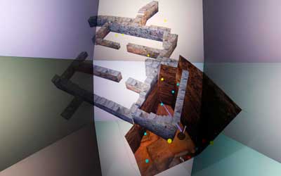
“These new approaches could benefit all kinds of projects, from gaining a whole new view of regions like Mongolia to tracking animal migrations to mapping the brain,” notes Lin. “The real trick is synthesizing the vast amounts of information we collect into something that can be understood. My colleagues and I use visualization techniques to sort, relate, and cross-link billions of individual data bits. We program it all into a file that allows us to re-render it into a digital 3-D world.”
Keep reading to learn how they cast that data into a 3-D room that you can move around in and explore the archaeology site – National Geographic – Albert Yu-Min Lin
