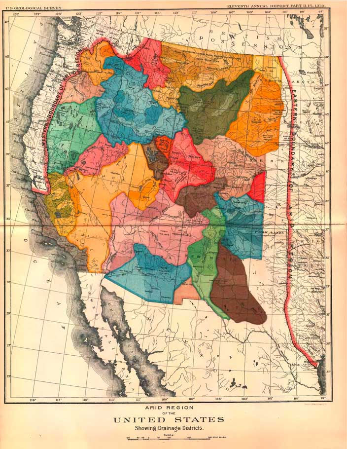
From Mapping the Nation:
A beautiful–and extremely controversial–map made by John Wesley Powell…best known for his insistence the west must be understood as an arid region, one that demanded irrigation and management rather than a reliance on rainfall. In the late 1880s, Powell undertook a large-scale survey of the far west to demonstrate that the region was made up of interdependent watersheds, or what he termed irrigation districts.
And he brought this knowledge before Congress in 1890 asking them to use this map as the foundation for establishing Western states. At the time they were distributing large parcels of land – in no particular order – through the Homestead Act.
They didn’t listen and the dream of a sustainable West – without water problems – was lost.
