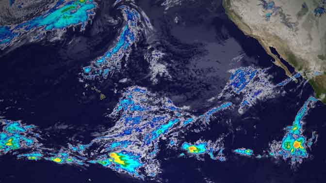
The National Ocean and Atmospheric Administration (NOAA) brought online its latest weather satellite GOES-15, and pushed aside its predecessor GOES-11.
It will be tracking the weather for California, the west coast, Hawaii, and the Pacific Ocean. The image above is the first infrared image it sent to NOAA, which it will continue to do every “15-30 minutes, with full hemisphere scans every 3 hours until its retirement.”
The term GOES stands for Geostationary Operational Environmental Satellite. Which means that they sit, like a star, at the same place in the sky and a radio antenna can be permanently pointed at it to receive data.
There are currently four of them covering our globe:
- GOES-12 – South America located at 60°W.
- GOES-13 – East located at 75°W. It provides most of the U.S. weather information.
- GOES 14 – in on-orbit storage at 105° W.
- GOES 15 – West and Pacific Ocean located at 135° W.
They are up there to track half the world’s weather patterns and to “track space weather, oceanographic changes, forest fires and other hazards and provide scientific data collection and information for search and rescue operations.”
As the name implies, there are 15 or more of these satellites up in space. Some are online, one is in storage ready-for-action, others are floating space junk, and a few are floating nonchalantly but providing data (like one at the North Pole).
Next time you look up at the stars keep an eye out for one of these satellites and you can bet they will be keeping an eye on us.
—
For more information, science writer Gary Robbins has a profile on GOES-15 vs GOES-11.

Leave a comment