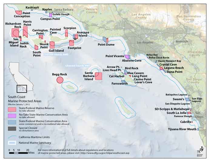
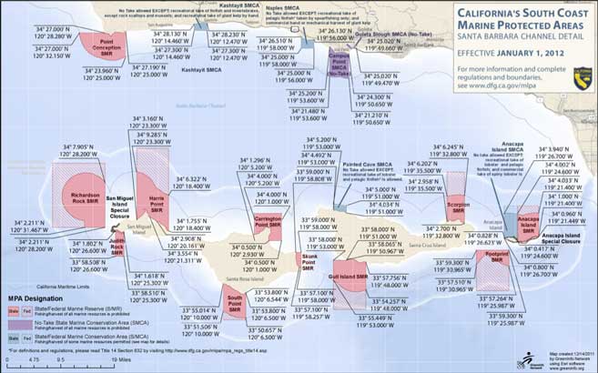
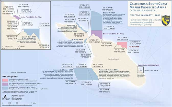
A map of all the Southern California MPA’s (marine protected areas), defined as:
A space in the ocean where human activities are more strictly regulated than the surrounding waters – similar to parks we have on land.
They are supposed to form a network of safe areas for marine life ro repopulate and bring back big populations to our oceans. You can see that they aren’t that large, nor extensive, but serve as a good starting point.
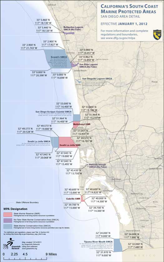
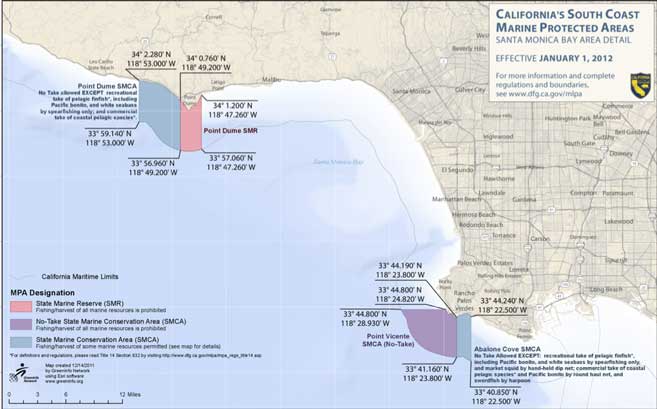
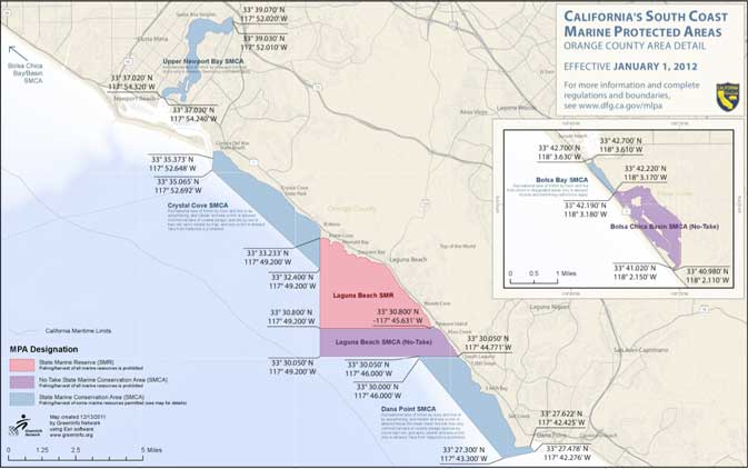
Here are maps for each of the regions: San Diego, Los Angeles (Santa Monica Bay), Orange County, Santa Barbara, Catalina Island.
**Full-size graphics are available at Cal Oceans – Maps
