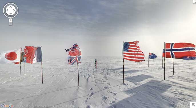
One of the focuses of this special addition to Google Maps is to teach users about the history of Antarctic exploration and the people who first set up shop in this bleak environment.
Here’s what Google’s technical program manager for Street View Alex Starns wrote in a blog post:
In the winter of 1913, a British newspaper ran an advertisement to promote the latest imperial expedition to Antarctica, apparently placed by polar explorer Ernest Shackleton. It read, “Men wanted for hazardous journey. Low wages, bitter cold, long hours of complete darkness. Safe return doubtful. Honour and recognition in event of success.” While the ad appears apocryphal, the dangerous nature of the journey to the South Pole is certainly not–as explorers like Roald Amundsen, Robert Falcon Scott and Shackleton himself discovered as they tried to become the first men to reach it.
Partnering with the Polar Geospatial Center at the University of Minnesota and the New Zealand Antarctic Heritage Trust, Google has added 360-degree images of many historic spots, including the South Pole Telescope, Shackleton’s and Scott’s small wooden huts, Cape Royds Adelie Penguin Rookery, and the Ceremonial South Pole.
“They were built to withstand the drastic weather conditions only for the few short years that the explorers inhabited them,” Starns wrote, “but remarkably, after more than a century, the structures are still intact, along with well-preserved examples of the food, medicine, survival gear and equipment used during the expeditions.”
Learn more: c|net – Google Maps visits Antarctica’s snowy landscape
Inside the houses of the first explorers:
// Thx – Simon Meacham
